What Is elands?
eLands® is an web application developed, maintained, hosted, and owned by Forcorp. It contains land management focused modules used to:
- Navigate transactional business processes.
- Complete operational and strategic landbase planning.
- Synchronize and summarize data collected through associated mobile applications.
- Manage and distribute detailed information for multi-stakeholder collaboration and decision making processes.
Land Use Modules
Land Withdrawal Module
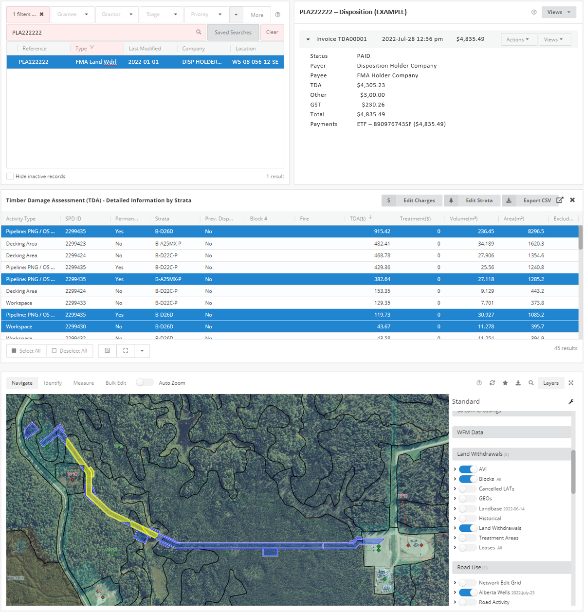
The Land Withdrawal module is a process management tool designed to streamline the steps, and efficiently manage the information, associated with land withdrawal requests on Forest Management Agreement (FMA) areas. Requests proceed through the system automatically, moving to the next step only once they have satisfied systematic and manual review.
FEATURES
- Receive land withdrawal consent requests directly to the system.
- Spatially process requests, perform initial validation, and calculate preliminary/draft Timber Damage Assessment (TDA).
- Deliver consent documents to requester (once consent is approved).
- Receive land withdrawal approval documents directly to the system.
- Deliver a TDA invoice to requester (once invoice is manually reviewed and adjusted as required).
- Track TDA invoice payment status in the Accounting module.
- Track activity states over time (amendments, ownership changes, etc.).
- Centrally store history of activity over time (requests, notifications, files, comments, etc.).
Road Use Module
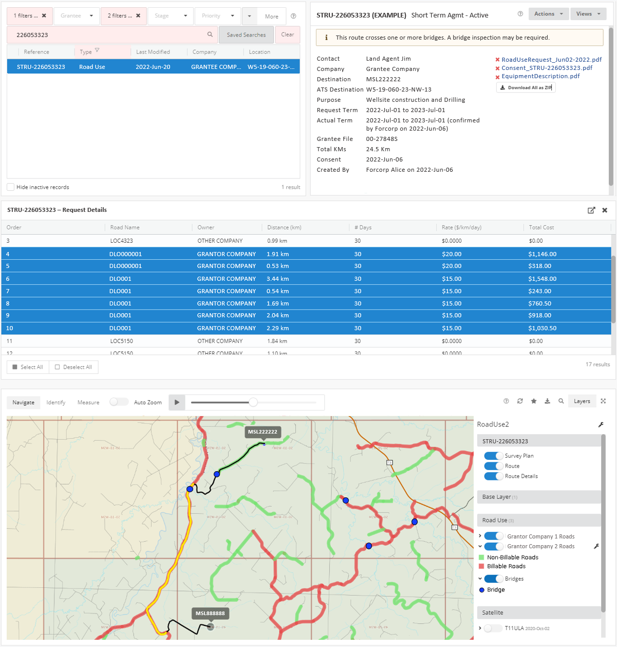
The Road Use module is a process management tool designed to streamline the steps, and efficiently manage the information, associated with industrial road use requests. Requests proceed through the system automatically, moving to the next step only once they have satisfied systematic and manual review.
Features
- Receive road use requests and notifications directly to the system.
- Capture spatial routes utilizing Forcorp’s proprietary road network.
- Spatially process requests to generate road listing, distance and rate, as well as to identify special conditions for use of particular roads.
- Deliver consent documents, rules of the road, and maps to the road user (once request is approved).
- Automated follow up with the road user to confirm road usage and further intentions.
- Deliver a road use invoice to the road user (once invoice is manually reviewed).
- Seamless transition from short-term/exploration (more intensive) to long-term/production (less intensive) road use.
- Track road use invoice payment status in the Accounting module.
- Incorporate government well data and other information sources regularly to validate use of roads.
- Centrally store history of request for future reference.
3rd Party Agreement Module
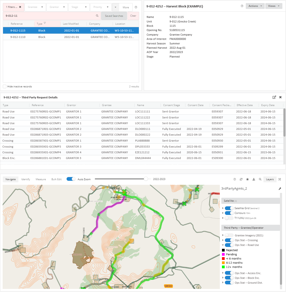
The 3rd Party Agreement module is a process management tool designed to streamline and track the progression of requesting and securing agreements from disposition holders to use or otherwise impact their dispositions while conducting industrial activities.
FEATURES
- The system automatically geoprocesses the grantee’s activity and identifies all the potential dispositions that are impacted by it (road use, crossing, encroachment, ground disturbance, etc.). Each of these impacts are manually reviewed and confirmed and approved, or deemed not required.
- For the impacts that are confirmed and approved, the system packages them by type and owner into a request package, including a cover letter, a listing of the dispositions impacted, and a map for each impact.
- The system accommodates flexibility in the order in which the response agreement is executed and considered active (there are a number of different approaches among companies) and tracks and stores each version of the agreement as it moves through the various stages of request, response, partial execution, and full execution.
Accounting Module
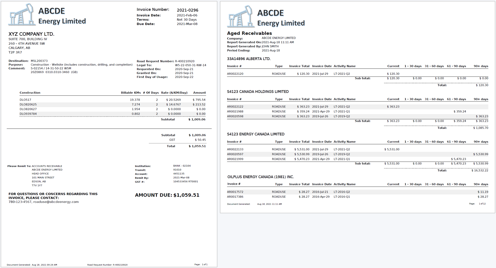
The Accounting module tracks the details and status (paid, unpaid, partially paid) of all invoices generated in the system as well as the details and status of the payments made by the payer to the payee.
FEATURES
- Invoices generated in eLands from Land Withdrawals, Road Use, and Land Use Agreement modules are automatically logged into the Accounting module.
- Due to the linkage of the invoice to a particular activity in the system, the activity associated with the invoice is readily accessible should there be a need to review and respond to related inquiries.
- Payments received from the payer along with applicable payment reference information are added as a payment, and the payment is allocated against the applicable invoice (or multiple invoices).
- Unpaid invoices are automatically identified at month end, and an account statement (detailing the payer’s unpaid invoices and recent transactions) along with any unpaid invoices are packaged and emailed to the payer.
- Unpaid invoices over a payee-defined age (e.g. 90 days) will automatically result in the particular payer being placed on the ‘hold list’ for that payee – this will place all further requests from this payer ‘on-hold’, requiring them to contact the payee to resolve the overdue invoice.
Natural Resource Management Modules
Scenarios Module
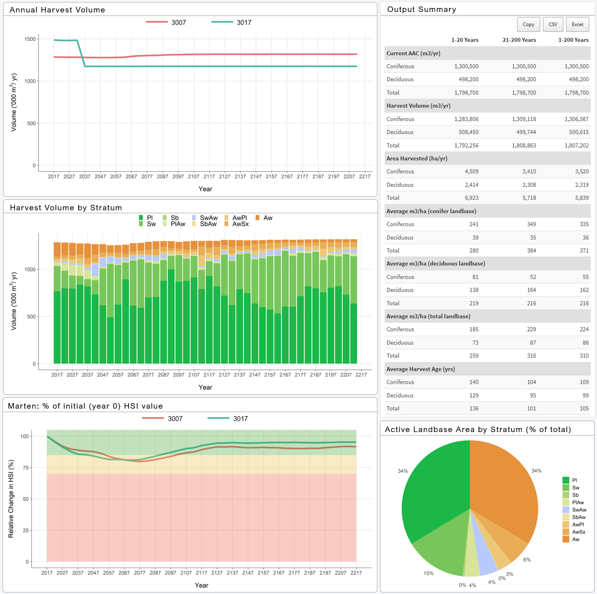
The Scenarios module is a custom-designed online platform developed by Forcorp and used to organize and present scenario modelling outputs for timber supply analysis, ecological value assessments, caribou habitat, and more.
FEATURES
- User-friendly interface organizes scenarios and presents results in a consistent style with attractive design elements.
- Secure user management system that only permits access to authorized parties, ensuring the confidentiality of sensitive information.
- Permitted parties can easily access and download up-to-date scenario outputs (including data tables, figures, and graphs), maps, and scenario comparison reports.
- Highly customizable and can be adapted to incorporate additional aspects of spatial planning and modelling as required, including using interactive elements to solicit stakeholder feedback.
- The module acts as a depository for modeling information and all outputs are stored in a secure, centralized system so that previous scenarios can be accessed at any time.
Spatial Sequencing Module
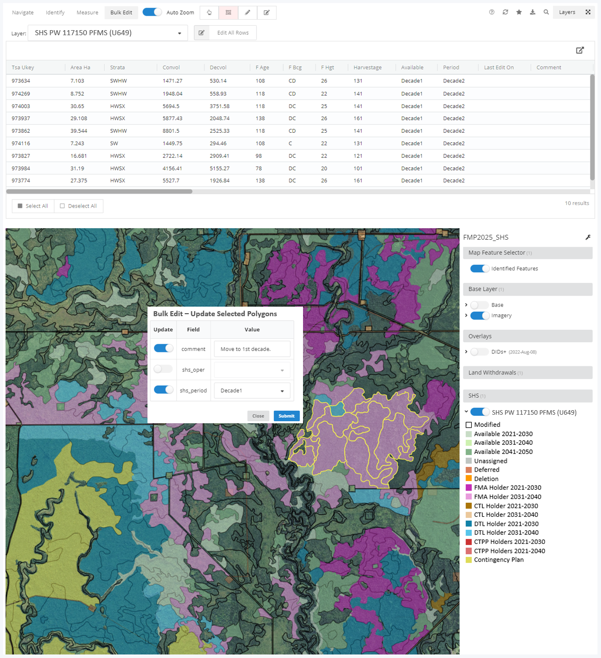
The Spatial Sequencing module is a process management tool created to allow organizations to review and edit their Spatial Harvest Sequence. The module is designed to facilitate and streamline collaboration between multiple parties.
FEATURES
- Permitted parties can review and edit spatial harvest sequences in real time.
- Clients can allocate operators, defer cutblocks, and assign harvest timing.
- All spatial sequencing changes are tracked and summarized by date and client name.
- Allocation targets and timber volume changes are instantly updated and displayed on the dashboard as edits are made.
Plots Module
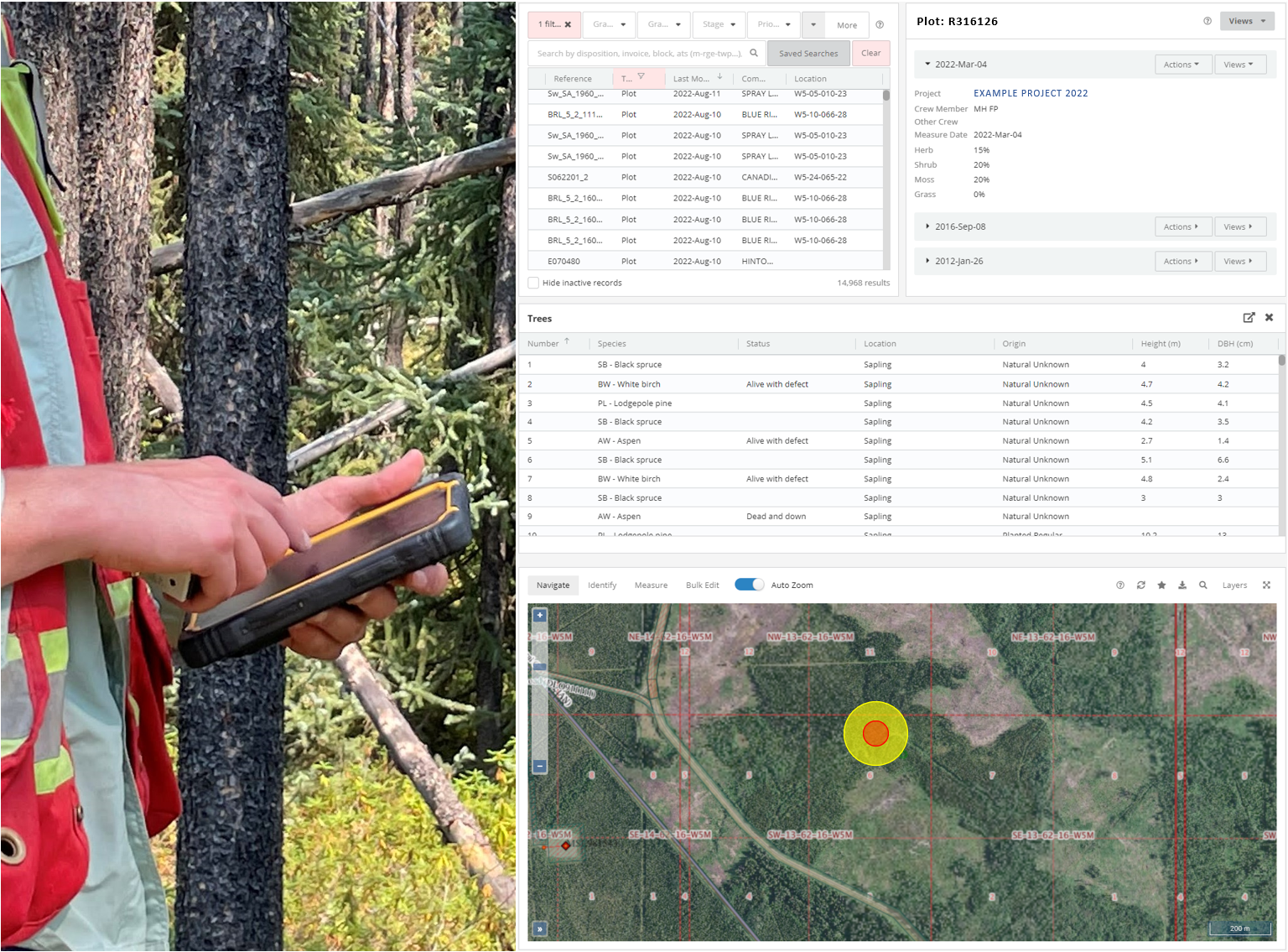
The Plots module is an integrated set of components used to capture, store, retrieve, and report on tree plot data. It was designed based on PGYI protocols and provides flexibility to accommodate company-specific differences from these protocols.
FEATURES
- The user-friendly Forcorp Plots app runs on Android tablets and is provided to clients on a subscription basis.
- The Plots app is calibrated for the collection of PSP, TSP, Pseudo-PSP, and RSA survey program data.
- Data entry fields utilize picklists where practical and direct typing where required, and missing entries are clearly identified so issues can be resolved before leaving the plot.
- Data is synced from the tablet and stored in the enterprise database and is available for assessment/analysis nearly immediately after it is collected, improving accessibility and allowing for progress monitoring.
- Authenticated eLands users can view and download data and plot level reports; for plots identified as PGYI plots, the module can generate the .csv files required for loading data into the PGYI database.
- Customizations to fields and features are available.
Stream Crossings Module
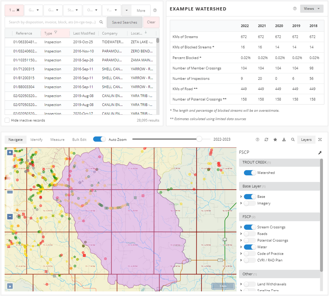
The Stream Crossings module was designed to meet environmental stewardship and safety requirements, which are a shared responsibility of industry and government. The Stream Crossings module allows members of the Foothills Stream Crossing Partnership (FSCP) to create, view, and download crossing inspection and watershed remediation reports, derived from field data collected and loaded to the system from mobile devices.
FEATURES
- The FSCP Inspection app is used to manage stream crossings and syncs crossing inspection data to a secure central repository (compatible with any Android device with a camera).
- The map panel in eLands displays FSCP data spatially through a number of key layers and mapping tools allow users to quickly update crossing information.
- A georeferenced PDF map can be generated and loaded into Avenza Maps to find locations in the field.
- Users can review crossing and inspection reports directly through the eLands dashboard or can download reports and their associated data in a variety of formats.
- Users can view watershed health reports that detail notable statistics for the selected watershed, as well as lists of priority remediation actions and improved crossings.
FAQs
How do I get access to eLands?
Email us at lands@forcorp.com and provide the following information:
- First and last name
- Phone number
- Email address (the email address of the person named above, not a generic email address that you and others within your company use)
- Company (if you are a land agent, provide the land agent company, not the company you will make requests on behalf of)
- Companies that you typically represent (if you are a land agent, provide the companies that you typically make requests on behalf of)
Which companies consent requests are handled by Forcorp in eLands?
FMA Land Withdrawal Requests
FMA6900016: Weyerhaeuser Company Limited (Grande Prairie)
FMA7500020: Blue Ridge Lumber Inc.
FMA8800025: West Fraser Mills Ltd. (Hinton)
FMA9000028: Millar Western Forest Products Ltd. (Slave Lake)
FMA9200030: Sundre Forest Products Inc.
FMA9700032: West Fraser Mills Ltd. (Edson)
FMA9700034: Canfor (Whitecourt) Forest Products Ltd.
FMA9700036: Vanderwell Contractors (1971) Ltd. (submit to eLands - Vanderwell will handle complete request)
FMA9900037: Canadian Forest Products Ltd. (Grande Prairie / Hines Creek)
FMA0200039: West Fraser Mills Ltd. (High Prairie) and Tolko Industries Ltd.
FMA0600043: Tolko Industries Ltd., Vanderwell Contractors (1971) Ltd. and West Fraser Mills Ltd. (Marten Hills)
FMA0900046: Weyerhaeuser Company Limited (Pembina)
Timber Quota, Road Use, Miscellaneous Requests
Blue Ridge Lumber Inc. 8063499-001
Canadian Forest Products Ltd. (Grande Prairie / Hines Creek)
Canfor (Fox Creek) Forest Products Ltd.
Canfor (Whitecourt) Forest Products Ltd.
Millar Western Forest Products Ltd. (Slave Lake) 1032015-002
Millar Western Forest Products ULC (Whitecourt)
Sundre Forest Products Inc. 8015493-001
Vanderwell Contractors (1971) Ltd. 0026229-001
West Fraser Mills Ltd. (Edson) 8039419-009
West Fraser Mills Ltd. (High Prairie) 8039419-010
West Fraser Mills Ltd. (Hinton) 8039419-004, 8039419-005
West Fraser Mills Ltd. (Slave Lake) 8053919-001, 8039419-003, 8039419-006
Weyerhaeuser Company Limited (Grande Prairie)
Weyerhaeuser Company Limited (Pembina)
How do I submit Consent Requests and Notifications?
What do I need to include with Consent Requests?
Below are the required components to include in the zip file that you submit with your consent request.
I - Forest Management Agreement (FMA) Land Withdrawals
- Cover letter containing:
- Grantee name and address
- Activity ID(s) and description and legal land description
- Consents type(s) you are seeking
- Agent and/or Grantee File number - Shapefile containing ALL permanent and temporary areas
- Format: ESRI Polygon Shapefile
- Projection: EPSG3400 – NAD83 / Alberta 10-TM (Forest)
- Must include files: .shp, .shx, .dbf and .prj. - Sketch or survey plan (in pdf format)
- Application (depending on submission pathway):
Option 1: Alberta Energy Regulator (AER) Disposition:
- Completed Public Lands Application for each Activity ID
Option 2: Alberta Environment and Parks (AEP) Disposition
- LAT Report
- Completed LAT Application Supplement(s) - Estimated timber volume: # loads and volume for each coniferous and deciduous timber
II - Timber Quota License (TQL) Land Withdrawals
- - All items listed above for FMA Land Withdrawals
- - Public Land Standing Report
III - Road Use
NOTE - Request road use once you have secured the disposition.
- Cover letter containing:
- Grantee name and address
- Destination ID (disposition or activity ID) and legal land description
- Agent and/or Grantee File number
- Purpose of use - Route map, detailing disposition, disposition owner and distance (Kms) requested for each road
IV - Miscellaneous Requests (Crossing, Approach, Parallel, Proximity, Encroachment)
NOTE - Request these once you have secured the disposition, unless the Land Withdrawal Consent addressed the miscellaneous request.
- Cover letter containing:
- Grantee name and address
- Activity ID(s) and description and legal land description of Grantor disposition interaction
- Consents type(s) you are seeking
- Agent and/or Grantee File number - Survey plan or sketch clearly showing interaction of activities/dispositions
What do I need to include with Notifications?
Below are the required components to include in the zip file that you submit with your notification.
Disposition Approval (including temporary dispositions)
- Copy of executed consent document, updated with the approved disposition number
- Government/Regulator approval documents
Disposition Cancellation
Government/regulator document confirming cancellation
Site Entry/Start-up/Commencement
Defined on the consent document issued for the disposition or the road use.
Rig Move
Complete notification form through eLands Wizard. No documentation required unless specifically requested by Grantor.
Legal Name Change or Acquisition/Merger of Companies
Depending on the circumstance:
- Certificate of name change
- Memorandum of registration
- Other relevant documents to substantiate the change
What is Timber Damage Assessment (TDA)?
Timber Damage Assessment (TDA) is the compensation owed to the Alberta Government and/or any Forest Management Agreement (FMA) holder on Crown forested lands that are no longer available for forestry use, due to a disposition (such as a wellsite, road, pipeline, powerline, etc.).
The Government of Alberta publishes the tables used in the process for determining the amount of TDA assessed for a given disposition. Information on the process and the current TDA tables can be found on the Alberta Government TDA Webpage.

